
Architectural Lectures & Workshops
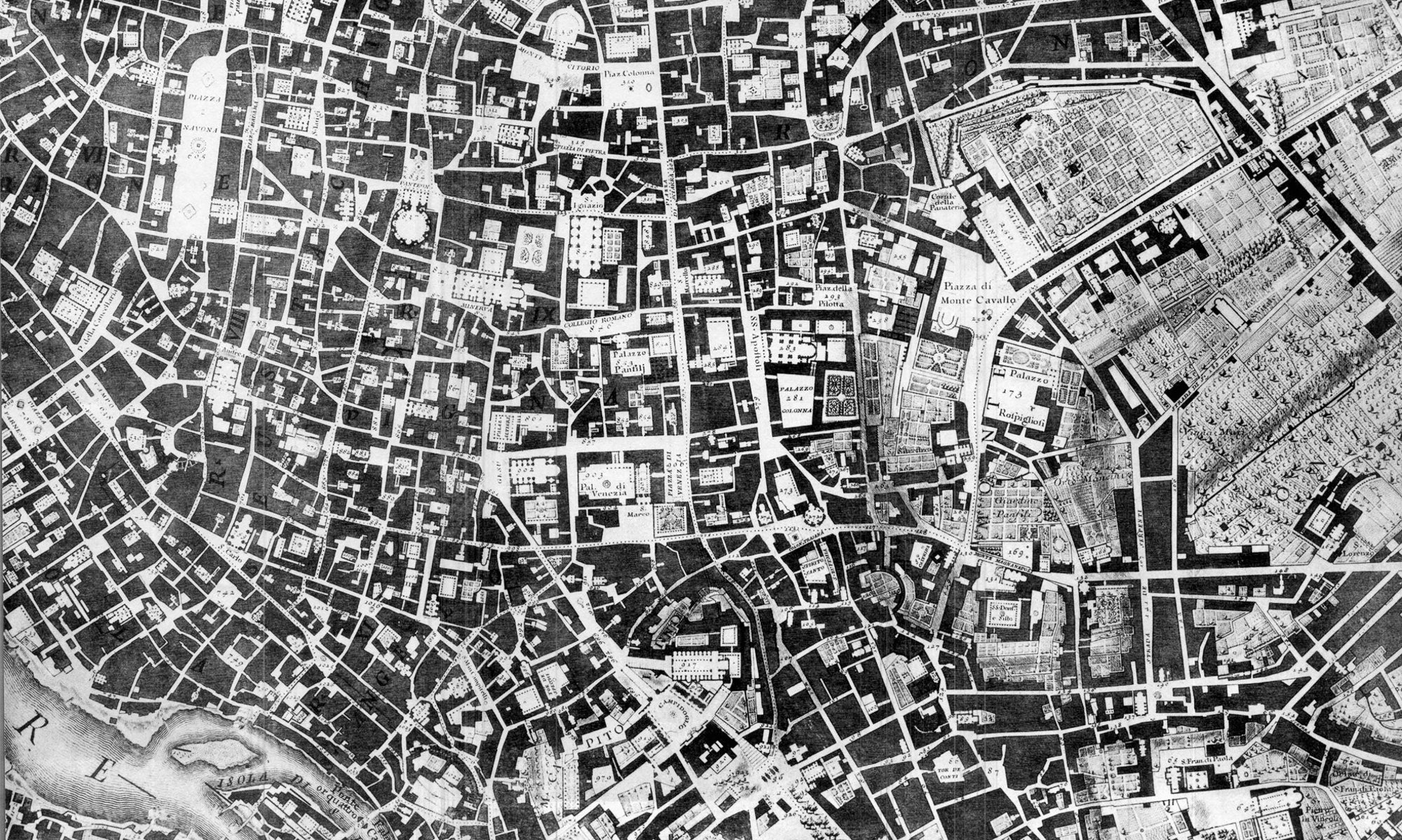
The Nolli Map of Rome, 1748
Urban Form & Mapping
Urban Form is the physical form that cities take as they evolve over time, to include the network of streets, public buildings, civic buildings, residential fabric and open spaces.
If we were to do an historical survey of the physical form of the city over time, we would see that much of the city, including the arrangement of the streets, the public buildings, and the residential fabric has changed in response to changes in social, political, and technical developments. The physical city is a reflection of culture, and as culture changes, the city responds. But we would also see that despite changes to the city fabric, there is one element that has resisted change: the urban square.
The urban square has changed little over the centuries. Perhaps the original concept of urban space was so perfect that it has met the needs of the public without needing major improvement.
In this workshop, we look at the city square as it has developed through history. We begin again with the Vitruvian Tale. As we look at city spaces, we compare them with the concepts we extracted from the myth: the concepts of center, boundary/edge, entry-passage, geometry and structure. Students begin to see that the little tale is an allegory for architectural design both at the scale of the building and at the scale of the city.
Then we take a look at historic cities, starting with Greece, and looking at both Classic and Hellenistic Athens, we then move through Priene and Miletus, then on to ancient Rome. Next we look at Medieval cities. We conclude with cities during the Renaissance.
After the historical survey, we conduct a mapping exercise of Renaissance Rome using the Nolli Map. The 1748 Nolli map of Rome by Giambattista Nolli, is regarded by scholars and cartographers as one of the most important historical documents of the city. The Nolli map is considered an ichnographic plan of Rome, which means that it is a map in plan view. The Pianta Grande di Roma, which he began in 1736 and finished in 1748, is now universally known as the Nolli map. The map is composed of 12 copper plates engravings, 3 across by 4 down, that together measure 176x208 cms.
Using one of the twelve plate sections of the Nolli Map, students analyze the urban form of Rome through an exercise in solid/void diagramming.
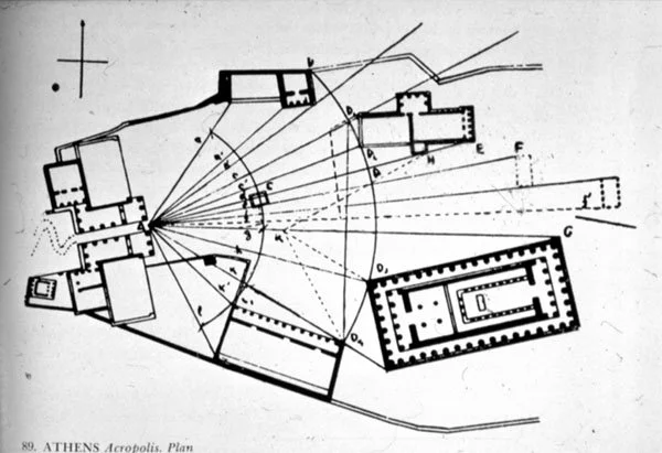
Plan of Acropolis, 400 B.C. image: Urban Space by French
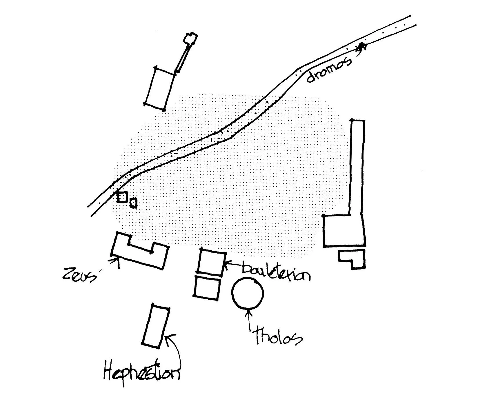
Diagram of Agora, Class. Per. image: Urban Space by French
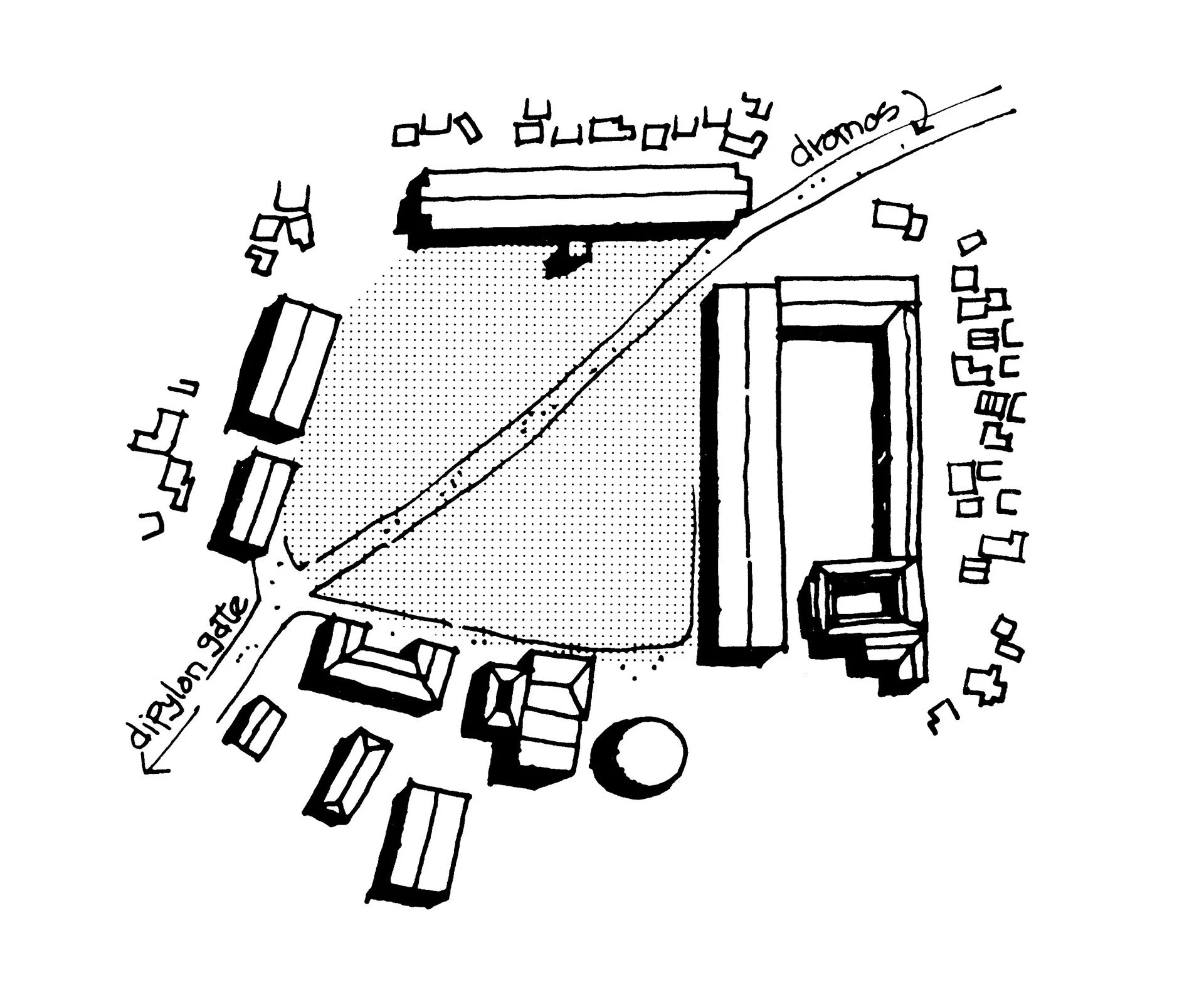
Diagram of Agora, Hell. Per. image: Urban Space by French
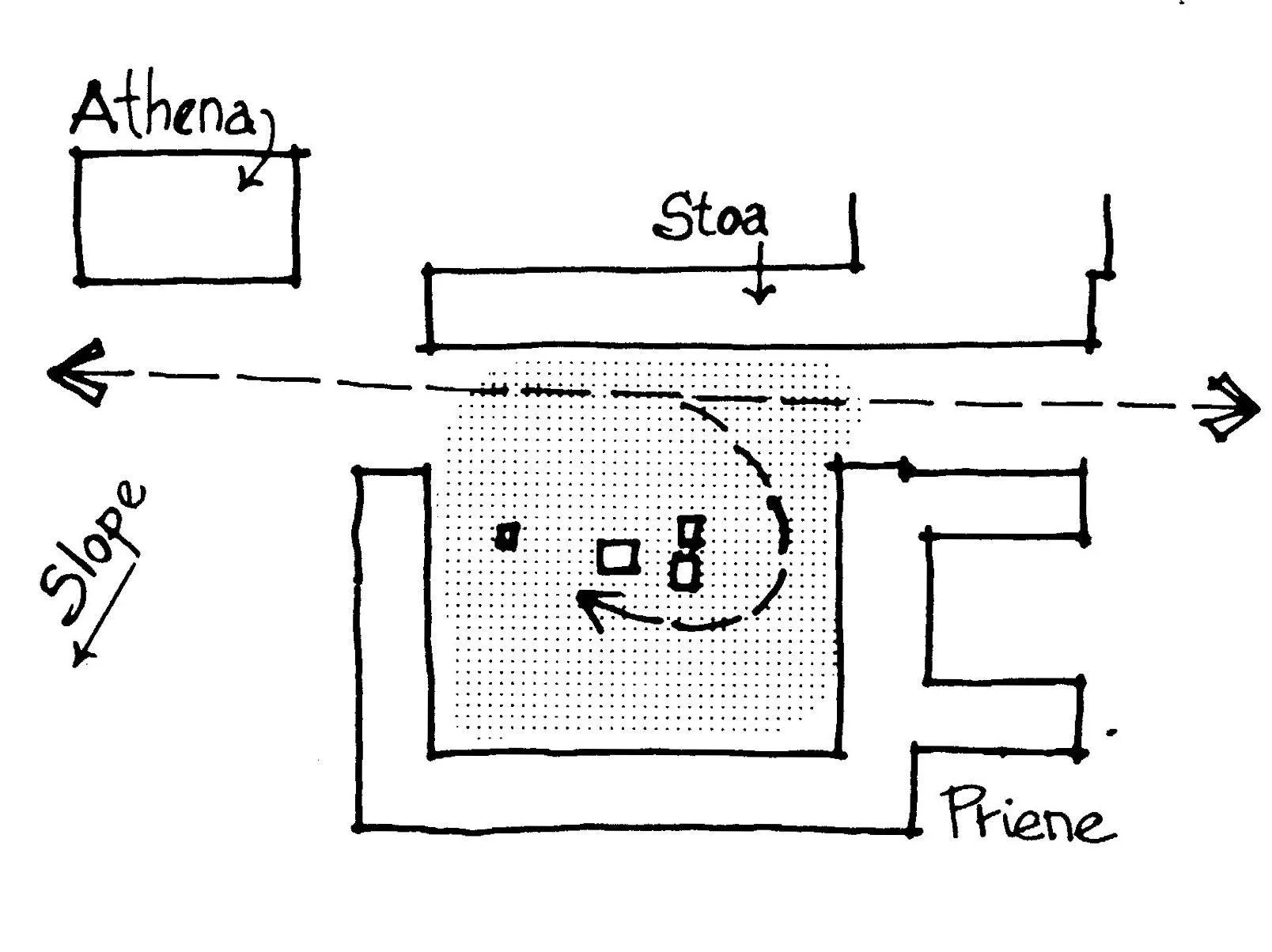
Diagram of Priene image: Urban Space by French
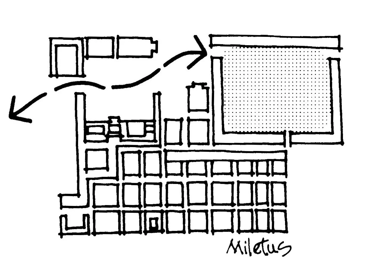
Diagram of Miletus image: Urban Space by French
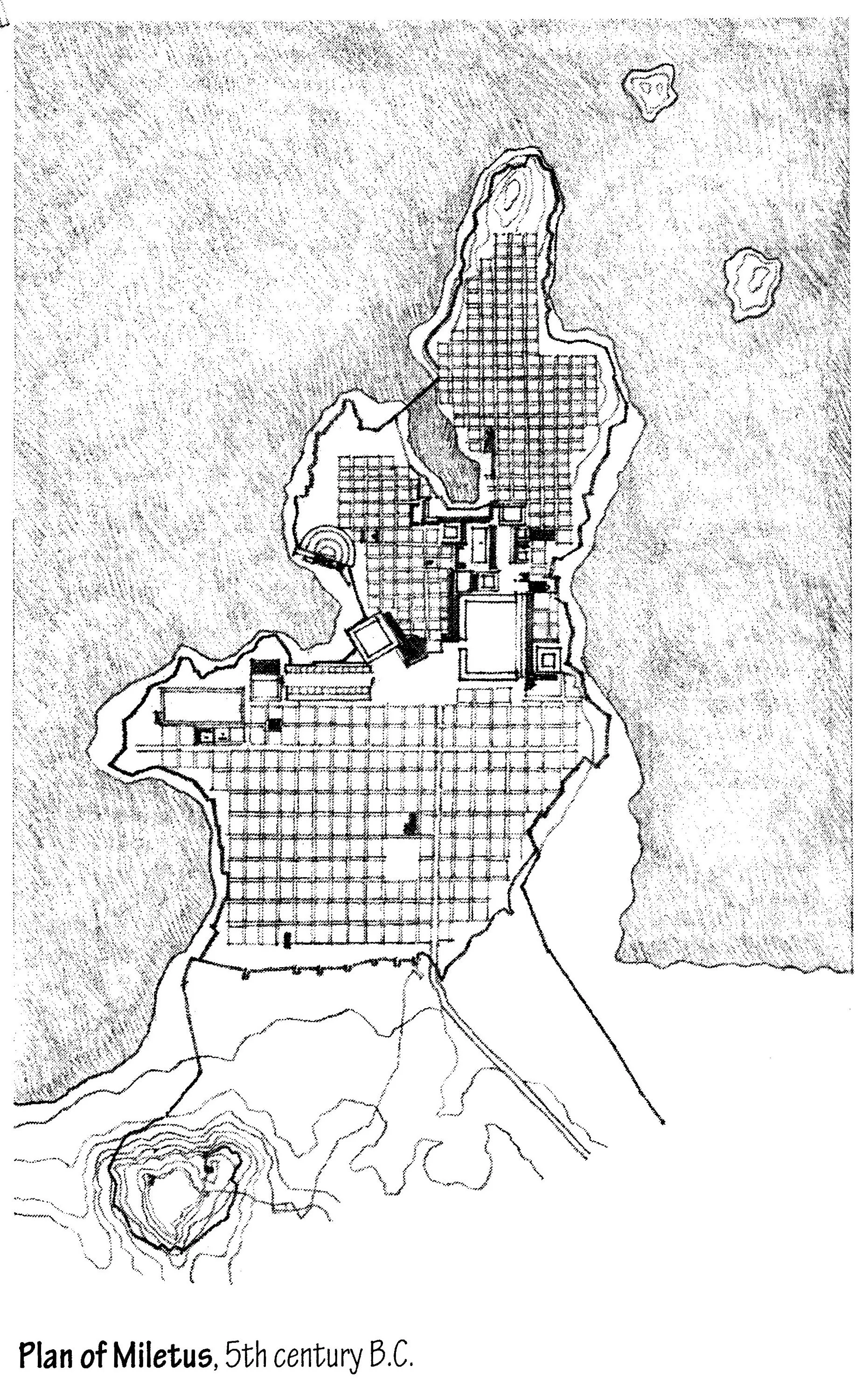
Plan of Miletus, 5th Century Ching: Form, Space and Order
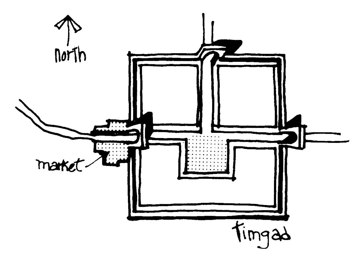
Diagram of Basic Roman Plan image: Urban Space by French
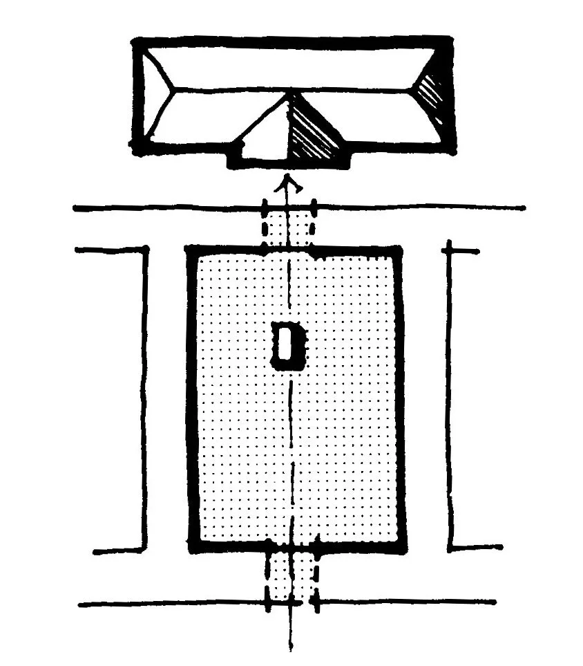
Diagram of Roman Square image: Urban Space by French
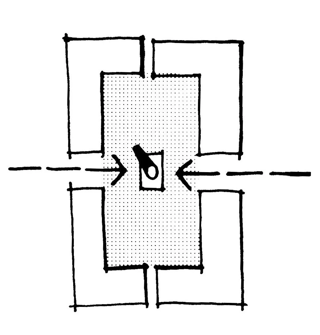
Diagram of Roman Square image: Urban Space by French
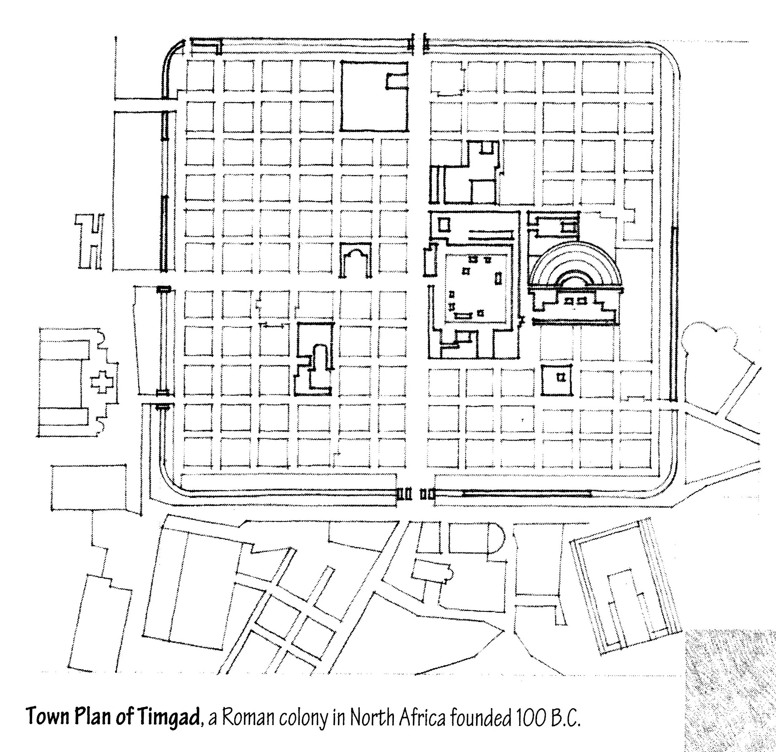
Plan of Timgad, 1000 B.C. Ching: Form, Space and Order
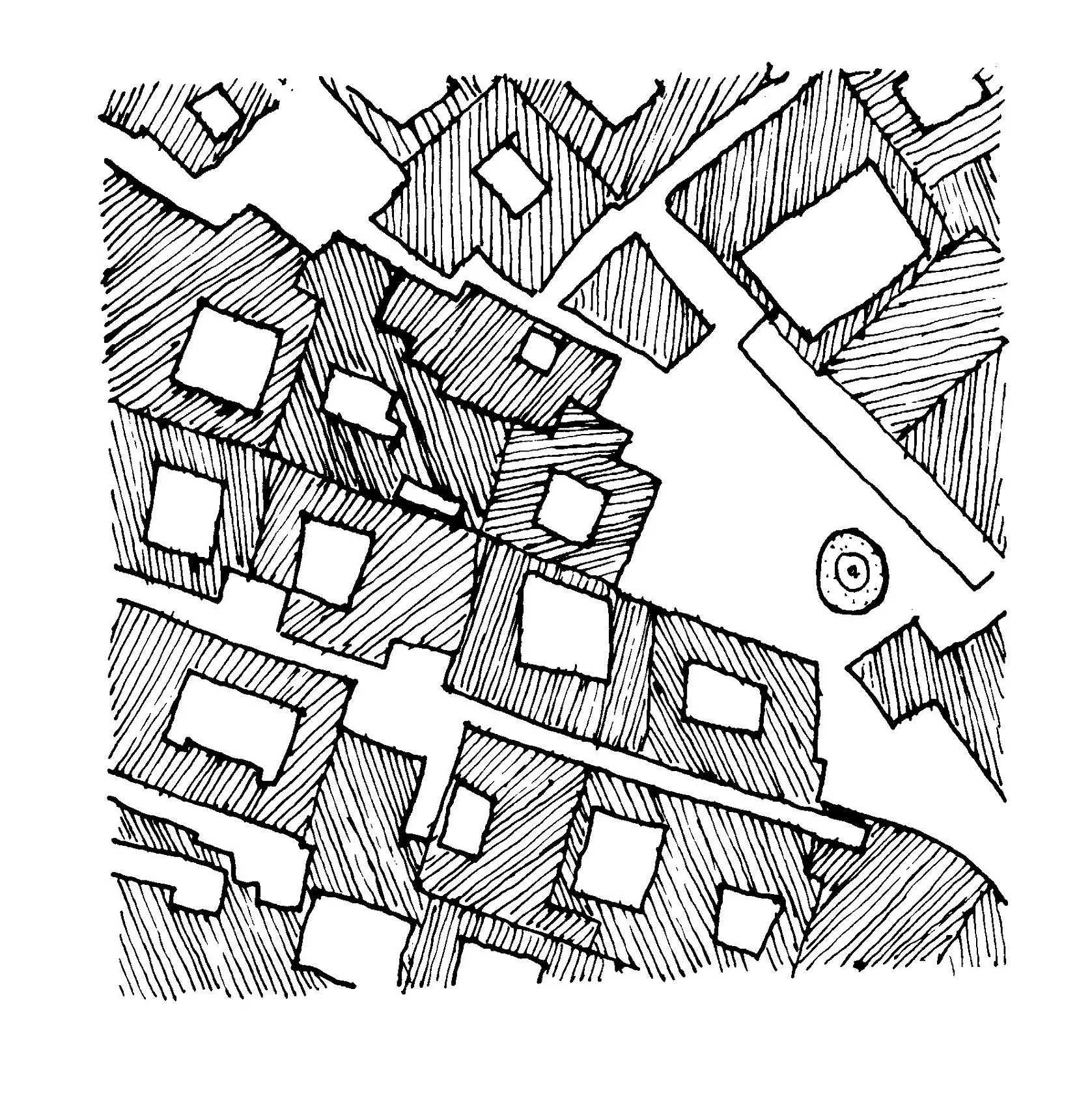
Diagram Solid/ Void image: Urban Space by French
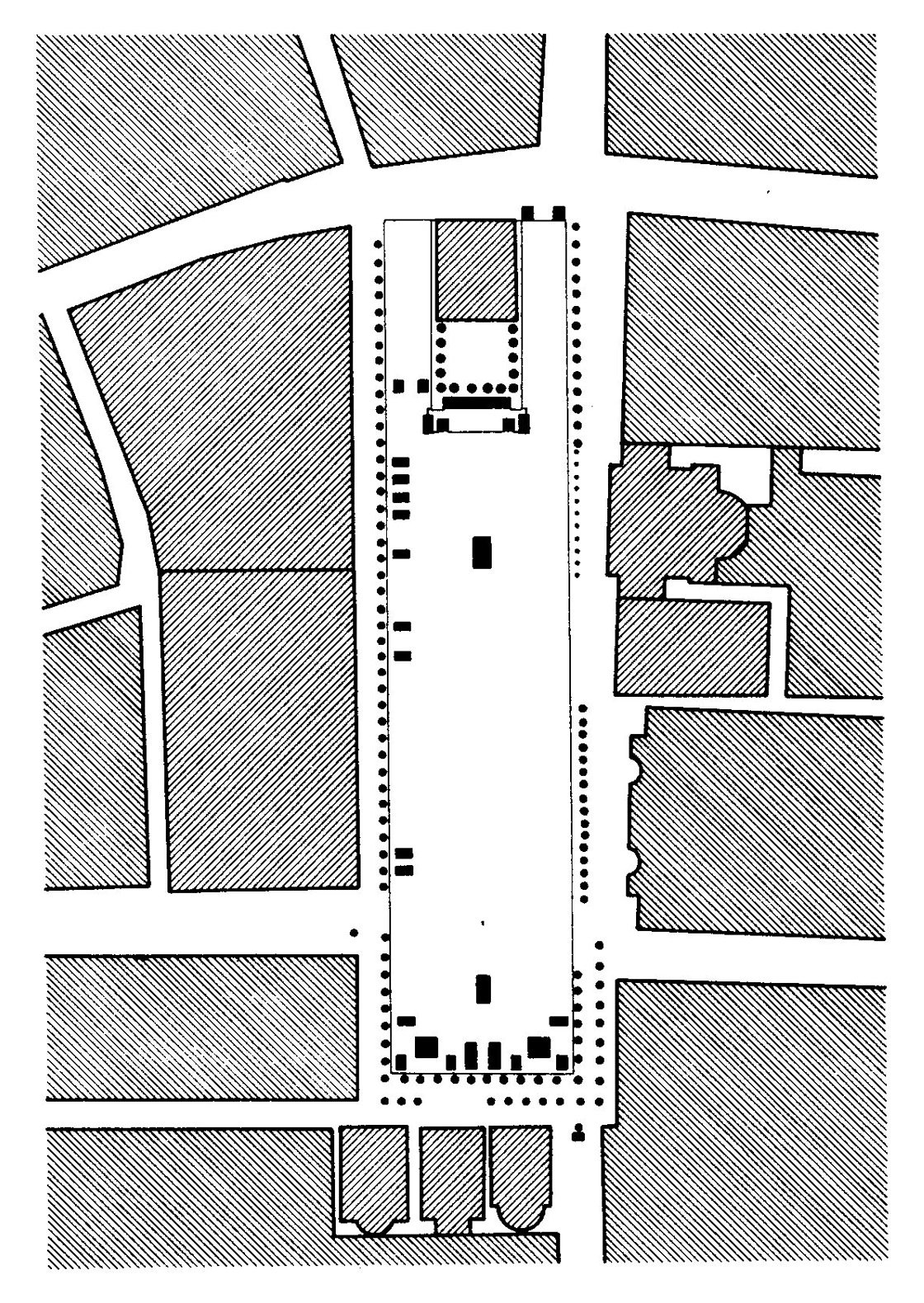
Diagram Pompeii image: Urban Space by French